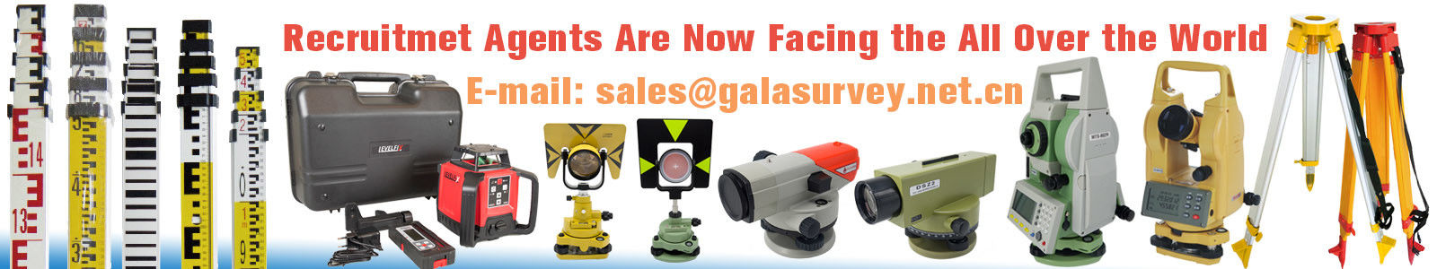
Product Description:
The MATO Total Station is a highly advanced surveying instrument designed to meet the demands of modern geospatial professionals. Combining precision, versatility, and user-friendly features, this total station is an essential tool for land surveying, construction, and engineering projects. It integrates cutting-edge technology to deliver accurate measurements with ease and efficiency.
One of the standout features of the MATO Total Station is its ability to operate as a GNSS receiver, allowing users to seamlessly integrate satellite positioning data with traditional total station measurements. This hybrid capability enhances the accuracy and reliability of surveying tasks, enabling professionals to perform a wide range of applications from topographic surveys to construction layout with confidence. The GNSS receiver functionality ensures that users can achieve precise positioning even in challenging environments where conventional methods might fall short.
The MATO Total Station is also equipped with a reflectorless total station capability, which means it can measure distances without the need for a prism or reflector target. This feature significantly speeds up the surveying process, as measurements can be taken directly from surfaces such as building facades, rock faces, or other hard-to-reach locations. The reflectorless mode enhances safety and convenience by reducing the need for surveyors to physically access hazardous or inaccessible areas.
Accuracy is paramount in any surveying instrument, and the MATO Total Station excels in this regard with its automatic compensator featuring a ±3 arc minutes range. This automatic leveling system ensures that the instrument remains perfectly aligned during measurements, compensating for minor tilts or misalignments. The result is consistently accurate data, reducing errors and improving the quality of survey outputs. This automatic compensator is especially beneficial in rough terrain or uneven ground conditions where manual leveling can be challenging.
The MATO Total Station supports multiple measurement methods including absolute, continuous, and diametrical modes. This versatility allows surveyors to select the most appropriate method for their specific task, whether it involves taking a single precise measurement or conducting a series of rapid observations. The absolute method provides direct coordinate measurements, continuous mode facilitates rapid data collection along a traverse or survey line, and the diametrical method enables circular or angular measurements with high precision.
Data management is streamlined with the MATO Total Station’s dual memory system, which includes internal flash memory and support for external SD cards. This hybrid memory setup ensures ample storage capacity for large-scale projects and provides flexibility in data transfer and backup. Surveyors can easily save, retrieve, and export measurement data in ASCII format, a widely compatible data format that facilitates seamless integration with various surveying software and geographic information systems (GIS). The ASCII format ensures that the data is easy to access, analyze, and share among project stakeholders.
Additionally, the MATO Total Station is designed with user convenience in mind, featuring an intuitive interface and robust construction suitable for field use. Its ergonomic design and durable build quality make it a reliable instrument for daily use in diverse environmental conditions. Whether working on urban construction sites or remote surveying locations, the MATO Total Station delivers consistent performance and dependable accuracy.
In summary, the MATO Total Station is a sophisticated and versatile surveying instrument that combines GNSS receiver technology, reflectorless total station capability, and an automatic compensator for precise leveling. Its support for multiple measurement methods and dual memory storage with ASCII data format ensures it meets the complex needs of modern surveying professionals. Trusted for its accuracy, reliability, and ease of use, the MATO Total Station is an indispensable tool for anyone requiring precise geospatial measurements.
Features:
-
Product Name: Total Station
-
Hs Code: 9015800090
-
Reflectorless total station with None Prism Distance up to 500m
-
Memory Type: Internal Flash Memory and External SD Card
-
Memory Capacity: 1G Mass Data Storage
-
Dust and Water Resistance: IP66 Rated for durable field use
-
Integrated GNSS receiver for enhanced positioning accuracy
-
Advanced reflectorless total station technology for precise measurements
Technical Parameters:
|
Transport Package
|
Carton
|
|
Trademark
|
MATO
|
|
Size
|
5.0″ Capacitive Multi-Touch
|
|
USB Port
|
With USB Port
|
|
Memory
|
Memory 1G Mass Data Storage
|
|
Memory Type
|
Internal Flash Memory And External SD Card
|
|
Method
|
Absolute, Continuous, Diametrical
|
|
Dust and Water Resistance
|
IP66 Rated
|
|
Auto Leveling
|
Automatic Compensator With ±3 Arc Minutes Range
|
|
Coarse
|
0.6s (initial 1.3s)
|
This reflectorless total station features advanced digital level technology, making it an ideal digital level instrument for precise and efficient surveying tasks.
Applications:
The Leica TS03 Total Station is an advanced surveying instrument designed to meet the needs of professionals in various fields such as construction, civil engineering, land surveying, and infrastructure development. As a high-precision device certified with CE standards, the Leica TS03 offers exceptional reliability and accuracy, making it a preferred choice among surveyors worldwide. With a minimum order quantity of just 1 PC and a competitive price of 6000 USD, this total station provides excellent value for both small and large-scale projects.
One of the key application occasions for the Leica TS03 is in construction site layout and monitoring. Its automatic compensator with a ±3 arc minutes range ensures precise angle measurements, critical for laying out foundations, roads, and buildings. The real-time operating system enhances operational efficiency, allowing users to perform complex calculations and measurements seamlessly on-site. Additionally, the internal flash memory combined with external SD card support allows for ample data storage and easy transfer, facilitating smooth project management.
In surveying projects requiring reflectorless measurements, the Leica TS03 excels with its impressive none prism distance of 500 meters. This feature allows surveyors to measure points that are difficult or unsafe to access, thereby increasing productivity and safety. The Leica TS03 stands out among other total stations like the Topcon total station and Sokkia total station by offering superior reflectorless capabilities and user-friendly operation.
The Leica TS03 total station is also widely used in topographic surveys, boundary delineation, and mapping. Its robust packaging, which includes a carton and plastic box, ensures safe transportation and delivery within 2-3 days. Payment terms are flexible with TT options, supporting smooth procurement processes. With a supply ability of 1000 pieces per month, Leica can meet the demands of large projects and distributors efficiently.
In summary, whether you are comparing it with a Topcon total station, Reflectorless total station, or Sokkia total station, the Leica TS03 offers a blend of precision, reliability, and ease of use. It is ideal for professionals looking for a CE-certified, high-performance total station with automatic leveling, extensive memory options, and long reflectorless distance measurement capabilities. The Leica TS03 is a smart investment for any surveying or construction task requiring accuracy and efficiency.
Customization:
Our Leica TS03 Reflectorless total station offers exceptional precision and reliability, certified with CE standards to ensure top-quality performance. As a trusted alternative to the Topcon total station, the TS03 is equipped with advanced features including a USB port for seamless data transfer and an impressive none prism distance of 500m, making it ideal for various surveying applications.
We provide flexible product customization services tailored to your needs. The minimum order quantity is just 1 PC, priced at 6000 USD, with a monthly supply ability of 1000 pieces to meet large project demands. Each unit is carefully packaged in a carton and plastic box to ensure safe delivery, with a typical delivery time of 2-3 days.
Our Leica TS03 total station is IP66 rated for dust and water resistance, ensuring durability in harsh environments. Payment terms are convenient with TT options available. Branded under MATO trademark, this product is an excellent choice for professionals seeking a reliable GNSS receiver integrated surveying instrument.
Support and Services:
Our Total Station product is supported by a dedicated technical support team committed to helping you achieve precise and efficient surveying results. We offer comprehensive services including product installation guidance, calibration assistance, software updates, and troubleshooting support. Our experts provide detailed user manuals and training resources to ensure you maximize the capabilities of your Total Station. Additionally, we offer maintenance services and repair solutions to keep your equipment in optimal condition. Whether you are a professional surveyor or a construction engineer, our support services are designed to help you overcome technical challenges and enhance your productivity.
FAQ:
Q1: What is the brand and model number of this Total Station?
A1: The Total Station is from the brand Leica, and the model number is TS03.
Q2: Is the Leica TS03 Total Station certified?
A2: Yes, the Leica TS03 Total Station has CE certification.
Q3: What is the minimum order quantity for the Leica TS03?
A3: The minimum order quantity for the Leica TS03 Total Station is 1 PC.
Q4: How much does one Leica TS03 Total Station cost?
A4: The price for one Leica TS03 Total Station is 6000 USD.
Q5: What are the packaging details and delivery time for this product?
A5: The Leica TS03 Total Station is packaged in a carton and plastic box, and the delivery time is 2-3 days.
Q6: What are the payment terms and supply ability for the Leica TS03?
A6: The payment terms are TT (Telegraphic Transfer), and the supply ability is 1000 pieces per month.

 귀하의 메시지는 20-3,000 자 사이 여야합니다!